Concepción de Ataco (Concepción de Ataco)
Concepción de Ataco is a municipality and city within the Ahuachapán Department, El Salvador. It has an area of 61.03 km ² and a population of 18,101 inhabitants (est. 2006).
The municipality administration is divided into 11 cantons, which are: El Arco, El Limo, El Naranjito, El Tronconal, La Ceiba, La Joya de los Apante, La Planxa, San Jose, Shucutitán and Texusín Chirizo. Atacos's population has pre-Columbian origin and was founded by Yaqui Indians or pipiles in central Apaneca Mountain Range.
In Nahuat, Ataco means "high place of springs.”
Concepción de Ataco's "sister city" is Elk Grove, California.
According to Archbishop Pedro Cortes y Larraz, Ataco in 1770 belonged to the parish of Ahuachapán. Its population consisted of 303 families with 784 indigenous people who spoke the Nahuat language of the Pipil people, they also spoke and understood Spanish.
In the colonial period Ataco belonged to the administration of the Izalco province or the Sonsonate municipality. As of June 12, 1824 belonged to the municipality of primitive and great department of Sonsonate. Due to the law of July 4, 1832 this town was made part of the jurisdiction of the judicial district of Ahuachapán. By legislative decree of February 8, 1855 the town was incorporated into the department of Santa Ana. According to a municipal report dated 20 April 1858, Ataco had a population of 972 inhabitants.
In 1866 the municipalities of Ataco asked the authorities, that the town be moved from the Santa Ana department to the Sonsonate department for the convenience of local interests. This application did not succeed.
By Legislative Decree dated 26 February 1869 Ataco joined the district and department of Ahuachapán.
In the year 1890 the city had 2,860 inhabitants.
In Concepcion de Ataco you can find stores that sell a wide variety of crafts including sculptures, ornaments, weavings, embroidery, candles, key chains and coffee. Ataco's native population still retains many of the customs and traditions of their grandparents—these go from generation to generation through oral tradition, preserving, so far, a bit of the culture and language (Nahuat).
Map - Concepción de Ataco (Concepción de Ataco)
Map
Country - El_Salvador
 |
 |
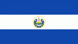
| Flag of El Salvador | |
Among the Mesoamerican nations that historically controlled the region are the Lenca (after 600 AD), the Mayans, and then the Cuzcatlecs. Archaeological monuments also suggest an early Olmec presence around the first millennium BC. In the beginning of the 16th century, the Spanish Empire conquered the Central American territory, incorporating it into the Viceroyalty of New Spain ruled from Mexico City. However the Viceroyalty of New Spain had little to no influence in the daily affairs of the isthmus, which was colonized in 1524. In 1609, the area was declared the Captaincy General of Guatemala by the Spanish, which included the territory that would become El Salvador until its independence from Spain in 1821. It was forcibly incorporated into the First Mexican Empire, then seceded, joining the Federal Republic of Central America in 1823. When the federation dissolved in 1841, El Salvador became a sovereign state, then formed a short-lived union with Honduras and Nicaragua called the Greater Republic of Central America, which lasted from 1895 to 1898.
Currency / Language
| ISO | Currency | Symbol | Significant figures |
|---|---|---|---|
| SVC | Salvadoran colón | 2 | |
| USD | United States dollar | $ | 2 |
| ISO | Language |
|---|---|
| ES | Spanish language |


